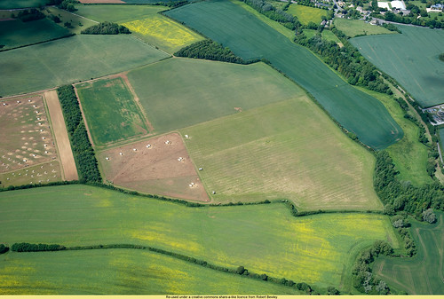
An aerial survey by Cambridge University
in July 1970 found cropmarks that showed Rathdown
was a medieval village or town
with signs of a castle, church and houses.
You can see the original photos HERE.
Can you work out where the village and castle
may have been from the markings on the ground?
What are crop marks?
When places where people once lived are deserted,
they become overgrown.
Eventually they are buried.
What is underneath the soil can affect
how the crops above them grow.
Ditches dug into the ground fill up
with soil over time. Crops grow well in these place.
They grow higher and look greener.
These create ‘positive’ cropmarks.
Where there are walls, floors or foundations underneath,
there is a thinner layer of soil.
Crops don’t grow as well on top of this rubble.
This creates ‘negative’ cropmarks.
Positive and negative cropmarks can be seen best from the air.
Click on this LINK to read more about cropmarks.
Click HERE for a very detailed excavation
at Rathdown dating from 1997.


